ACOE Florida Keys Carrying Capacity Study
Assessment of Nearshore Benthic Communities of the Florida Keys
Dr. James W. Fourqurean and Leanne Miller Rutten
Project Summary
There is a consensus that many changes in coastal marine ecosystems worldwide are
anthropogenically driven. It has been asserted that anthropogenic impacts are
responsible for degradation of coastal marine ecosystems in the Florida Keys,
however there is a paucity of data which support this conclusion. Accurate
quantitative assessments of the effects of human activity on the coastal marine
ecosystems of the Florida Keys are needed so that coastal residents, scientists,
and resource managers may focus their conservation, research, and legislative
efforts in the appropriate direction. This project entails an investigation of
nearshore (<1 km from shore) benthic communities of the Florida Keys and complements
the FKNMS seagrass monitoring project. It is designed to
identify spatial and temporal variations within nearshore benthic communities and
their associated nutrient regimes and to determine if these variations may be
associated with human land use activity in the Florida Keys. Working hypotheses
include:
- H1: Nearshore benthic communities and their associated nutrient regimes exhibit spatial/temporal variation throughout the Florida Keys.
- H2: Nutrient regimes of nearshore benthic communities exhibit a nearshore to offshore nutrient availability gradient in areas adjacent to onshore sources of nutrient enrichment in the Florida Keys.
- H3: There is a significant relationship between human land use activity and spatial/temporal variation of nearshore benthic communities and their associated nutrient regimes throughout the Florida Keys.
Phase two of this project will define the nutrient regime associated with the identified benthic communities by quarterly sampling events. Relationships between the benthic community types and the water quality characteristics will be used to formulate a predictive model that ties benthic cover change to land use change. Eventually, the results of this project may be incorporated into the development of a model which predicts the effects of land use activity and anthropogenic nutrient enrichment on nearshore benthic communities of the Florida Keys.
Study Area
Investigations will be concentrated in four areas of the Florida Keys: 1) Key West, 2) Big Pine, 3) Marathon, and 4) Key Largo. Study sites will be located in a nearshore zone (<1 km from the shoreline) in each of these four areas. It was necessary to limit the investigation to four areas of Florida Keys due to resource constraints. The four areas were selected because they include expanses of heavily developed urban areas adjacent to sparsely developed coastal ecosystems. The distribution of study sites within these four areas should provide excellent representations of nearshore benthic communities and nutrient regimes throughout the Florida Keys.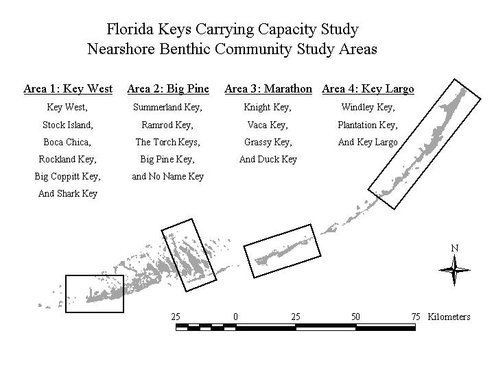
Progress Reports
FY 2000
January 2001
February 2001
March 2001