Synoptic Seagrass Maps for FKNMS
Benthic Habitat Survey Sites
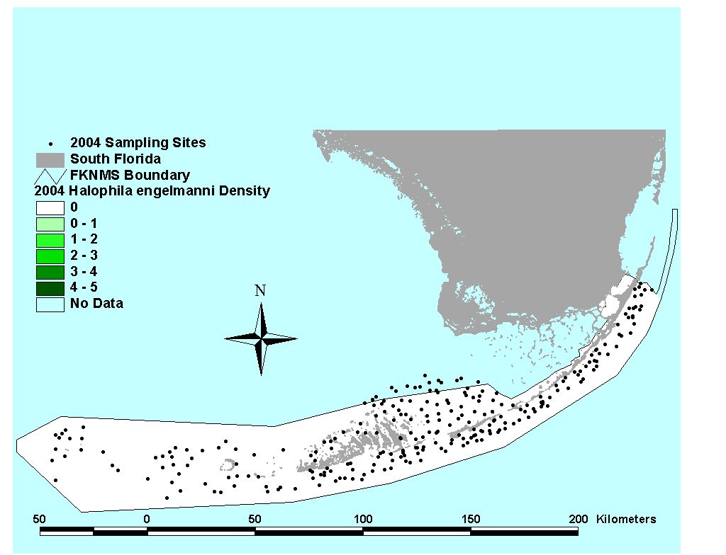
From 1996-2000, SERL researchers surveyed seagrasses across South Florida as part of a comprehensive benthic habitat assessment. A grid of tesselated hexagons was used to assign site locations, and a different GPS coordinate within each site hexagon was sampled from 1996-2000. Then, in 2003 and 2004, researchers re-sampled coordinates from 1996 and 1997, respectively. All sites are plotted on the map below. Results from these surveys were published in Fourqurean et al. 2001, Peterson and Fourqurean 2001, Fourqurean et al. 2002, Fourqurean and Zieman 2002, Fourqurean and Rutten 2003, and Campbell and Fourqurean 2009.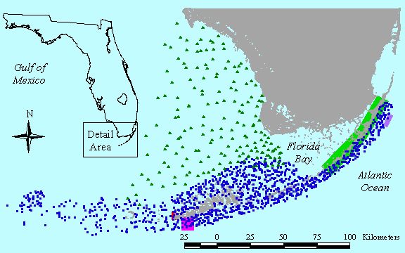
Click on the thumbnail below to view a full size map for each year
Summary (1996-2000)
Click to download list of coordinates
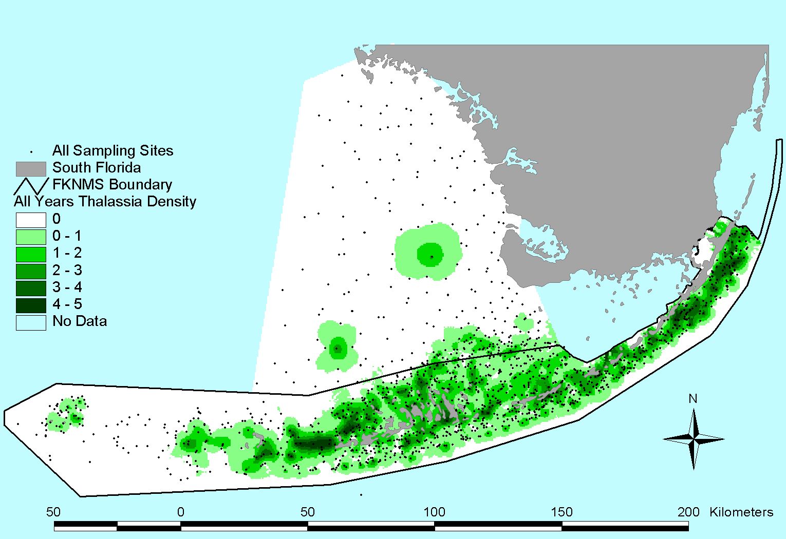
Thalassia testudinum |
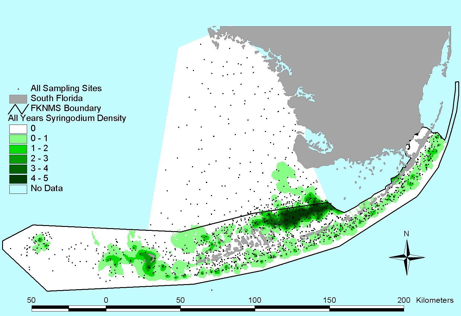
Syringodium filiforme |
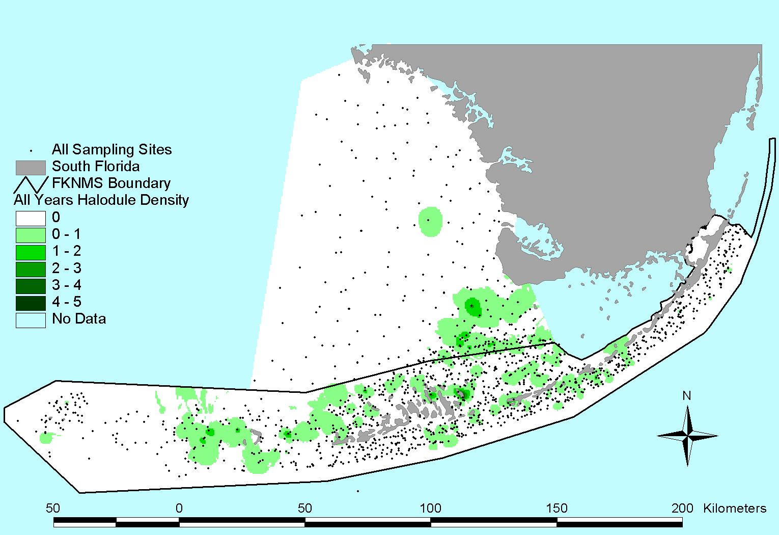
Halodule wrightii |
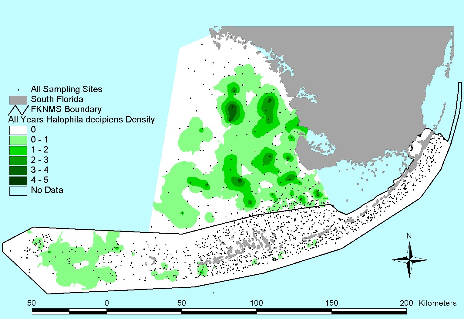
Halophila decipiens |
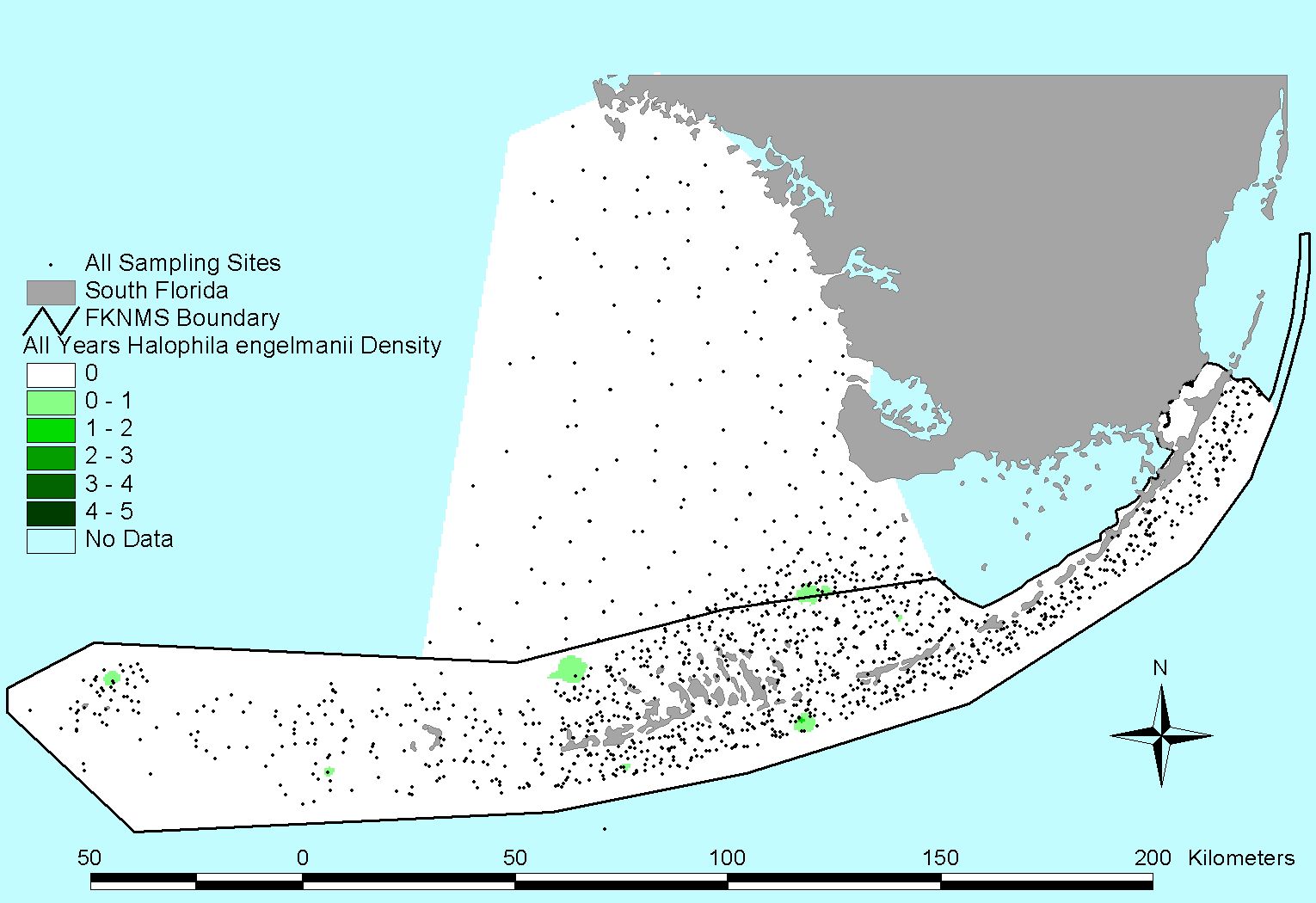
Halophila engelmannii |
1996 Survey
Click to download list of coordinates
(Sites sampled in 1996 were re-sampled again in 2003)
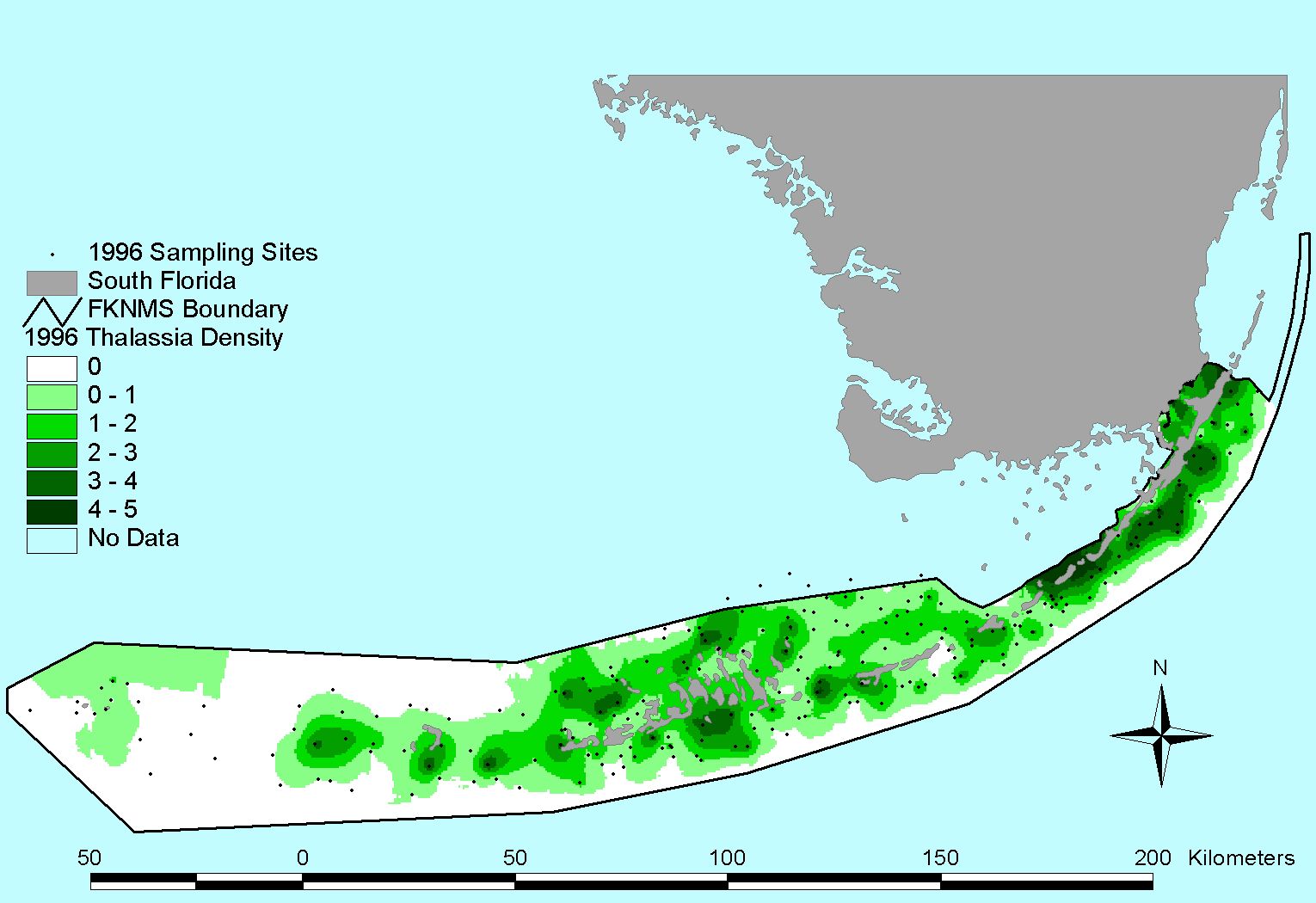
Thalassia testudinum |
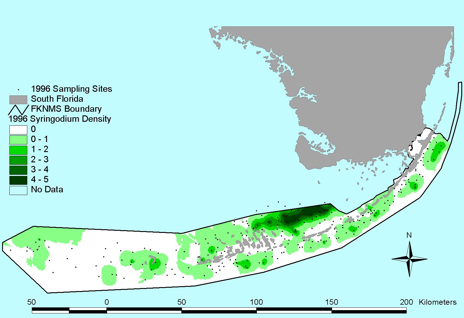
Syringodium filiforme |
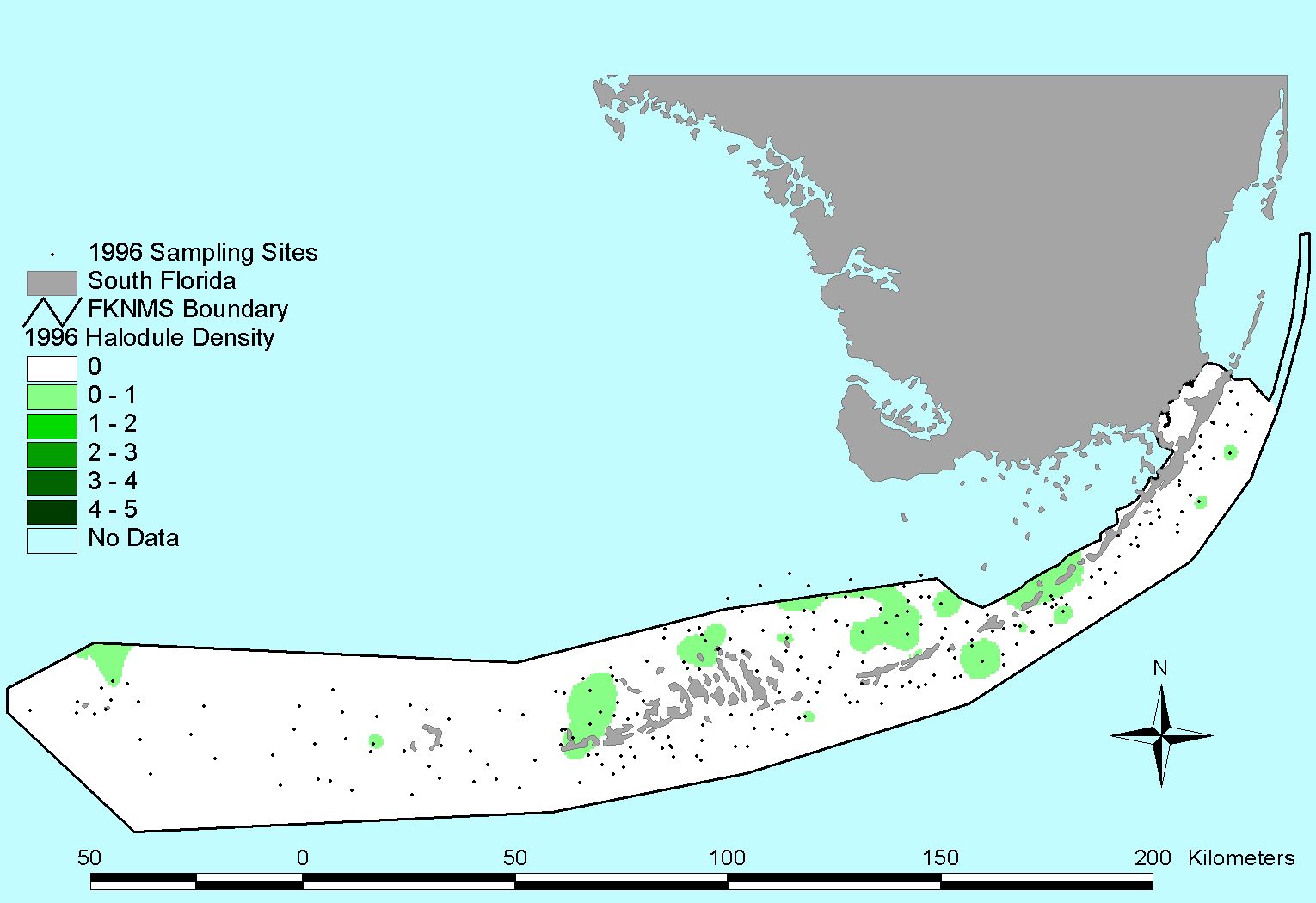
Halodule wrightii |
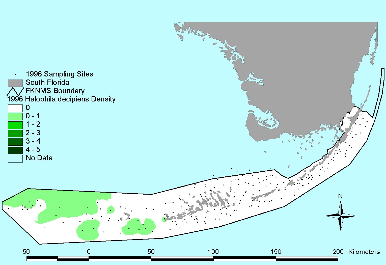
Halophila decipiens |
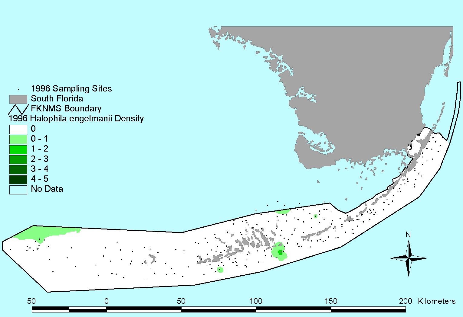
Halophila engelmannii |
1997 Survey
Click to download list of coordinates
(Sites sampled in 1997 were re-sampled again in 2004)
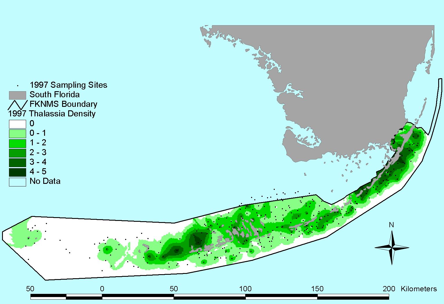
Thalassia testudinum |
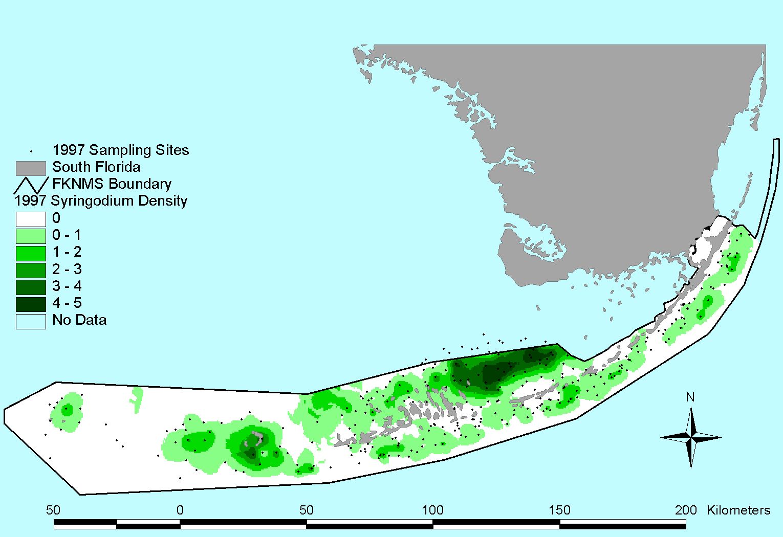
Syringodium filiforme |
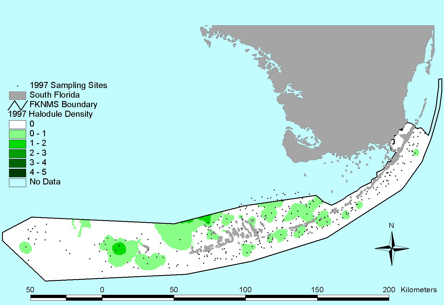
Halodule wrightii |
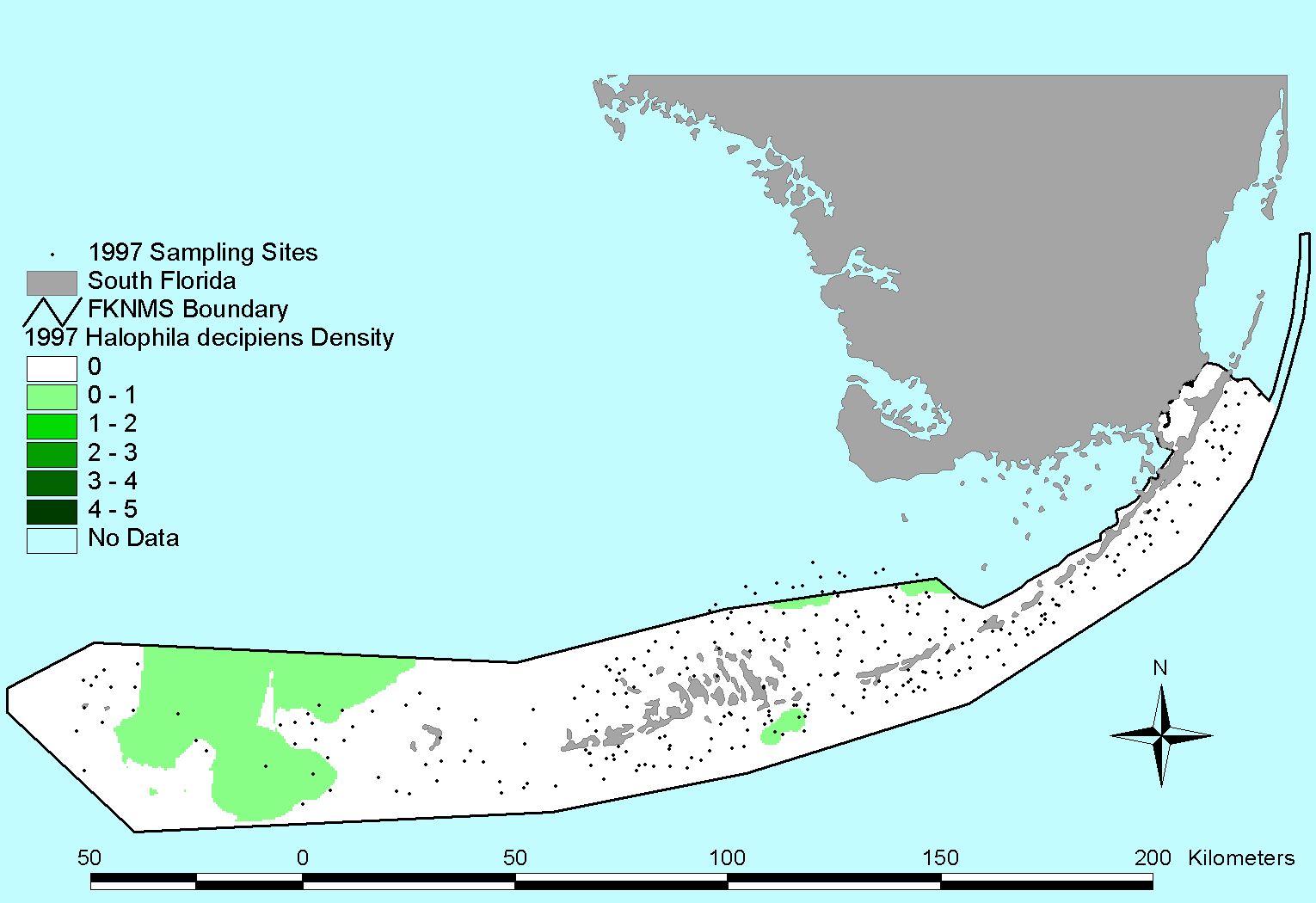
Halophila decipiens |
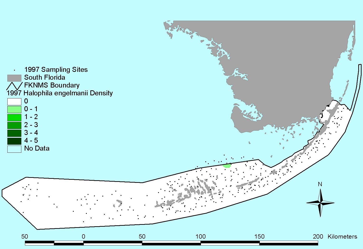
Halophila engelmannii |
1998 Survey
Click to download list of coordinates
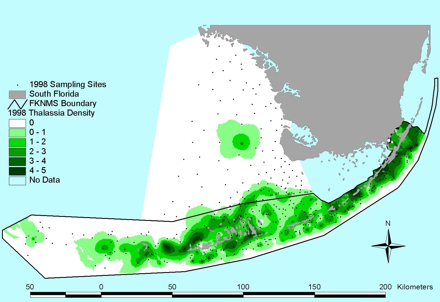
Thalassia testudinum |
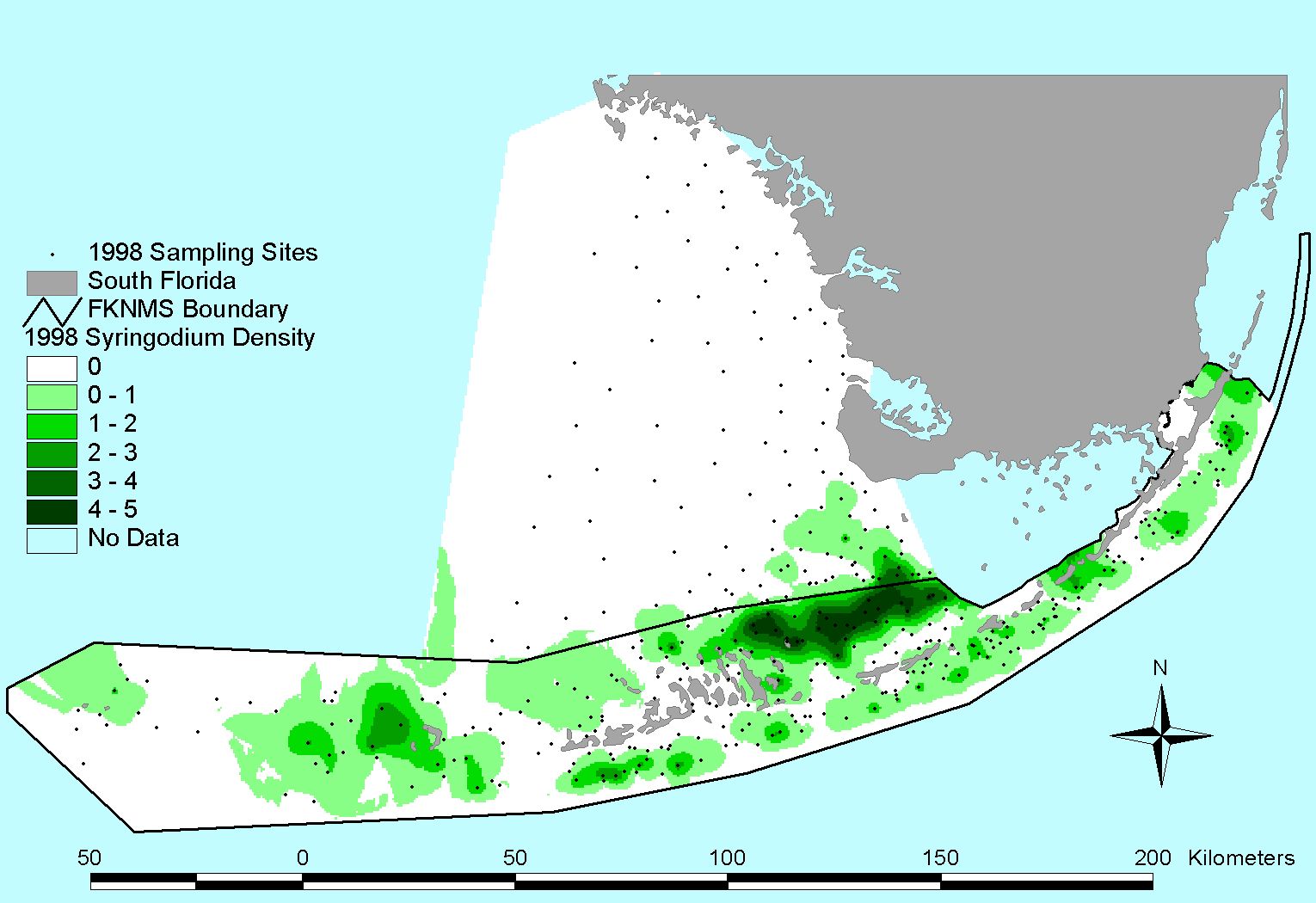
Syringodium filiforme |
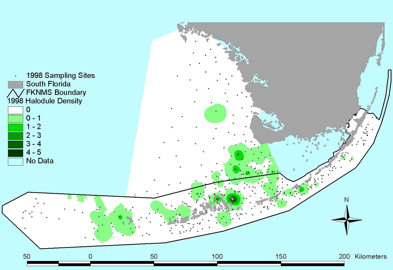
Halodule wrightii |
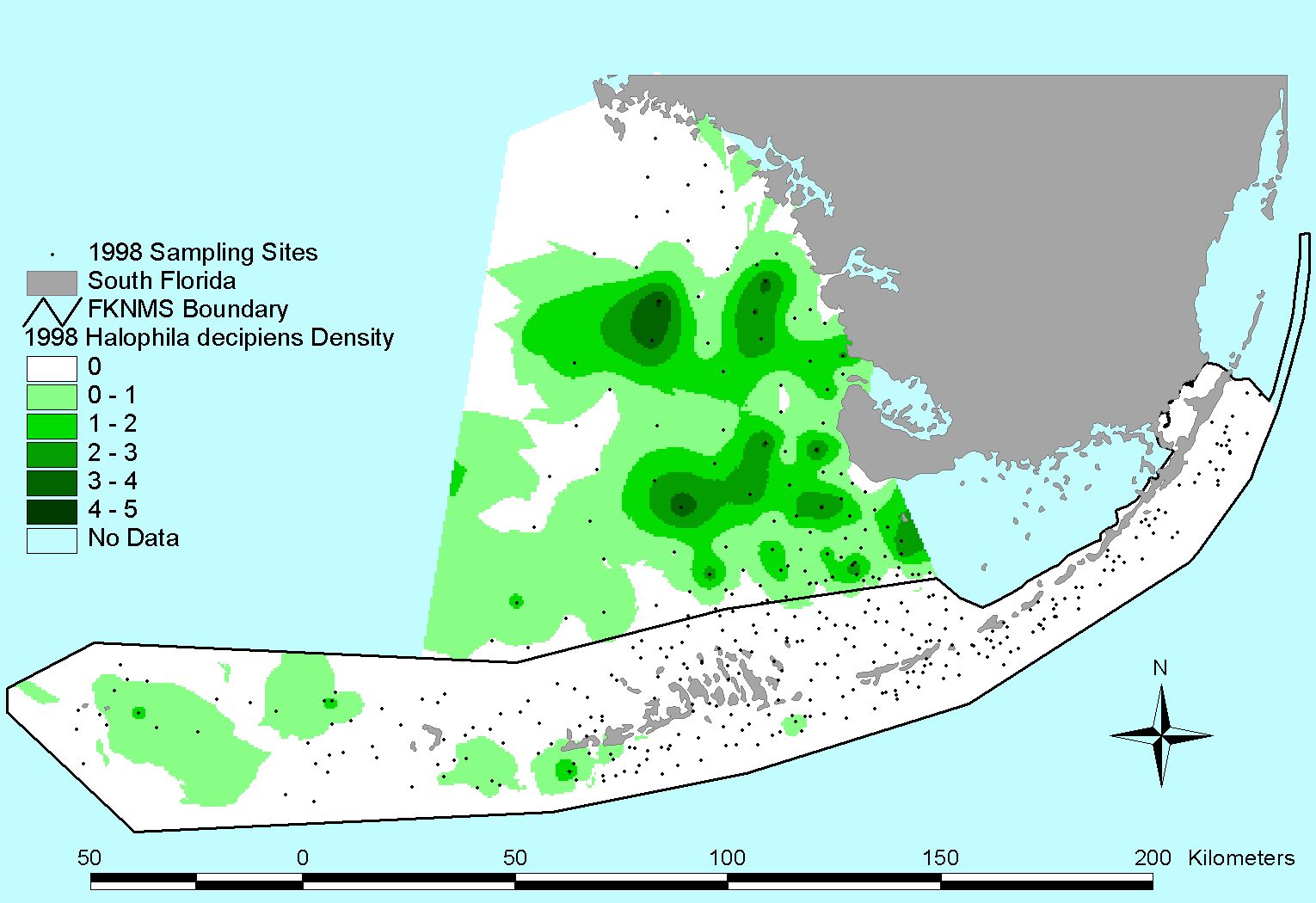
Halophila decipiens |
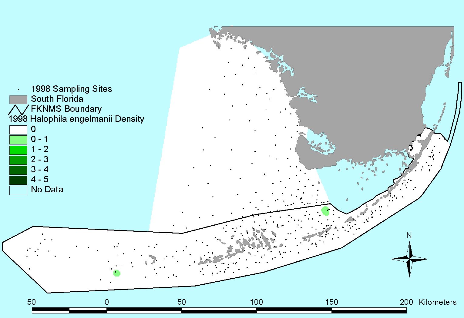
Halophila engelmannii |
1999 Survey
Click to download list of coordinates
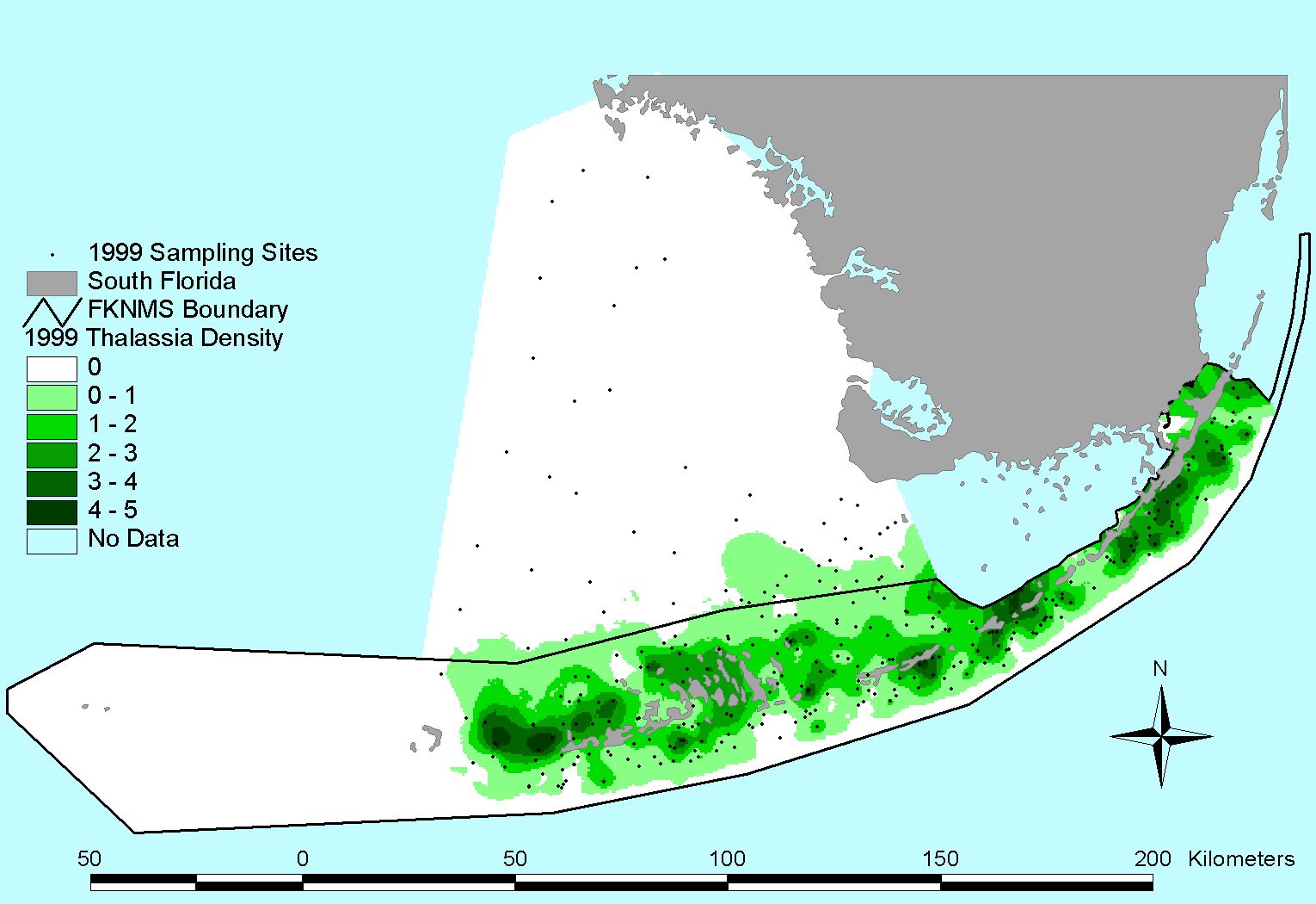
Thalassia testudinum |
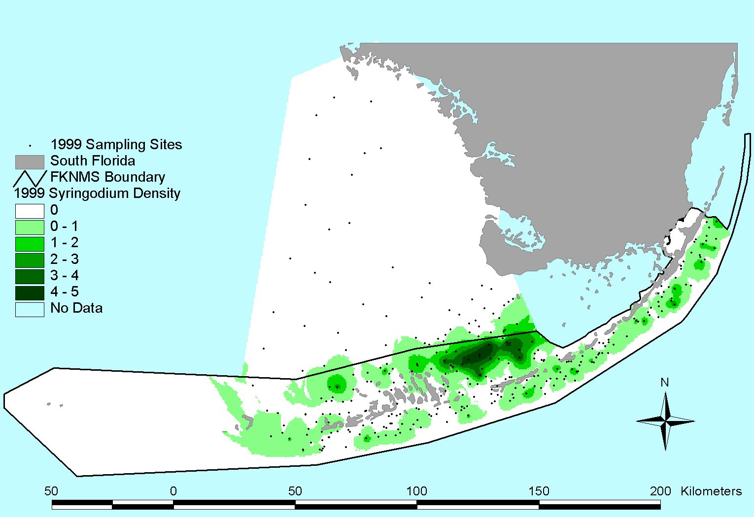
Syringodium filiforme |
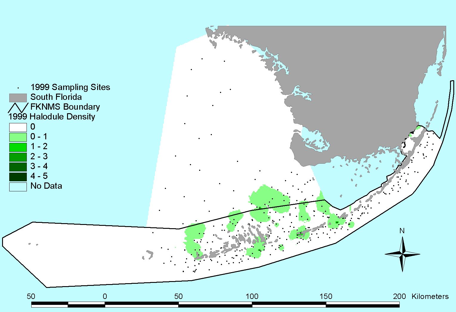
Halodule wrightii |
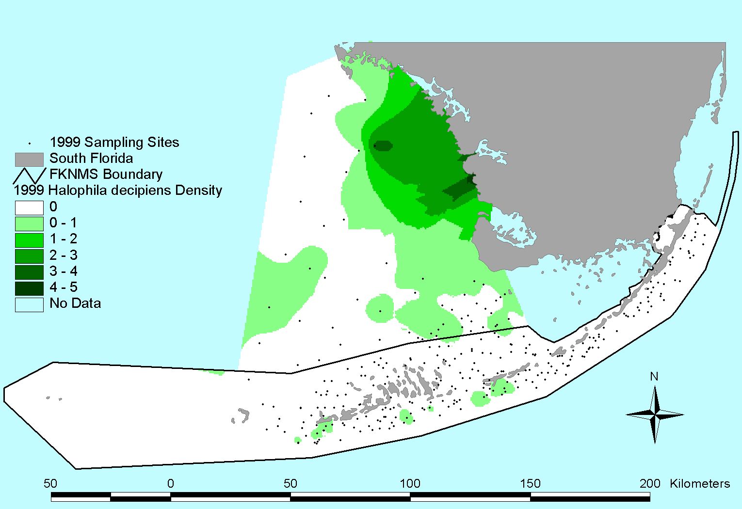
Halophila decipiens |
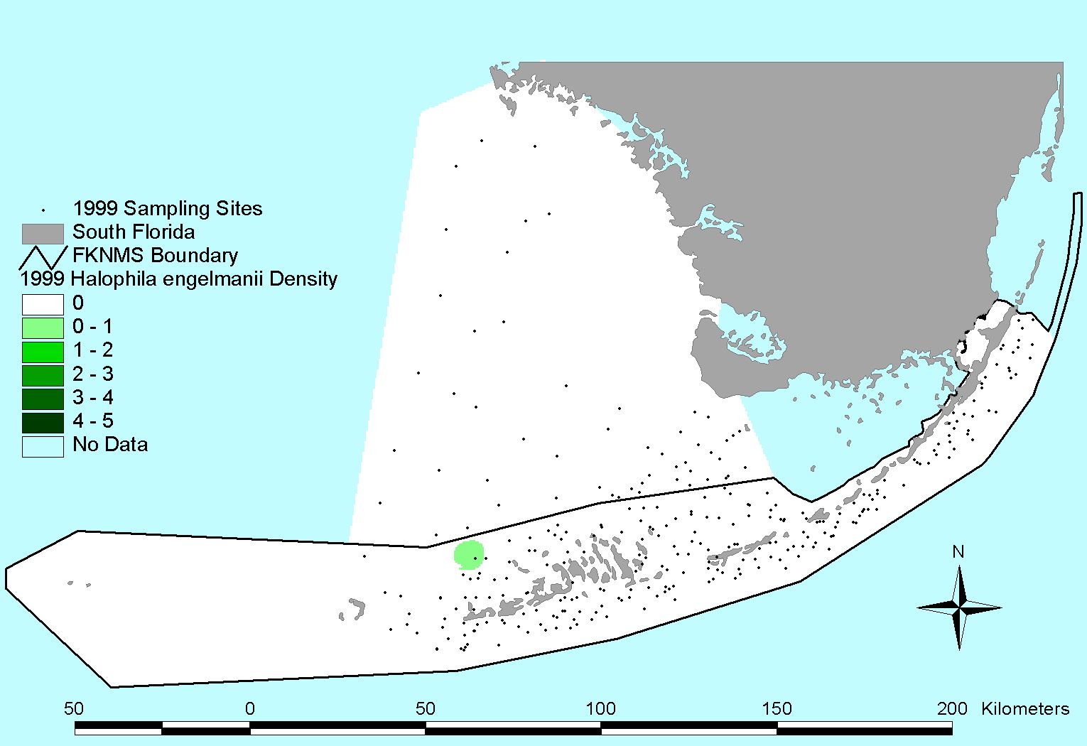
Halophila engelmannii |
2000 Survey
Click to download list of coordinates
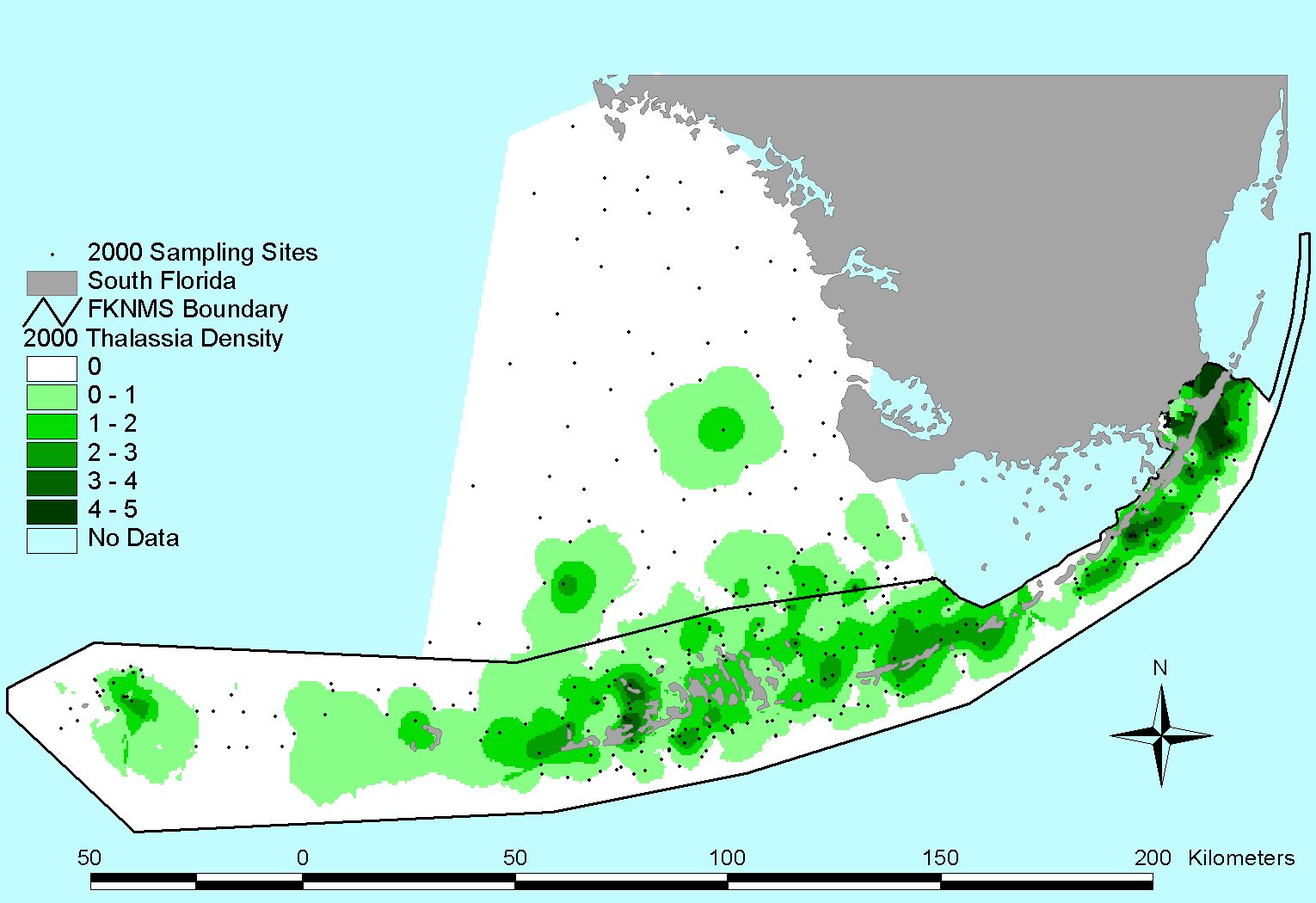
Thalassia testudinum |
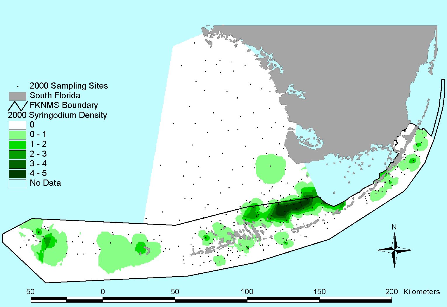
Syringodium filiforme |
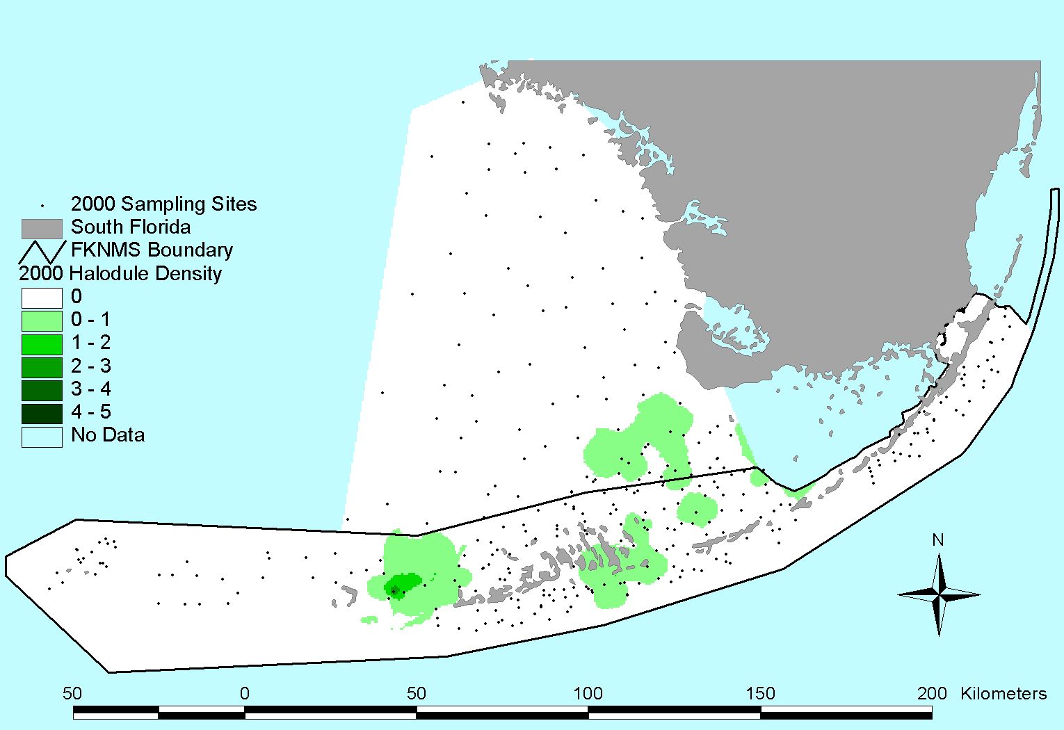
Halodule wrightii |
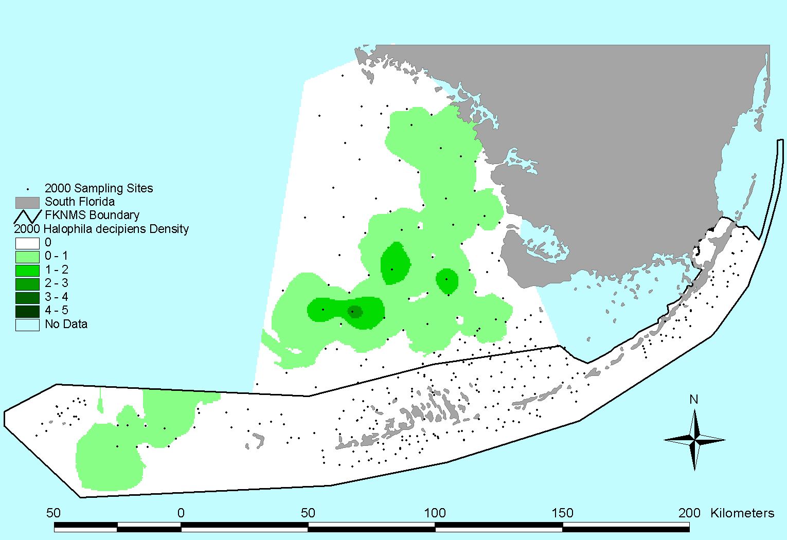
Halophila decipiens |
2003 Survey
Click to download list of coordinates
(Sites were sampled in 2003 at the same coordinates from 1996)
Detailed map of monitoring stations and links to digital photos
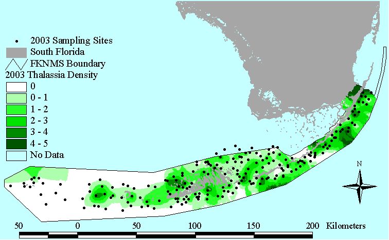
Thalassia testudinum |
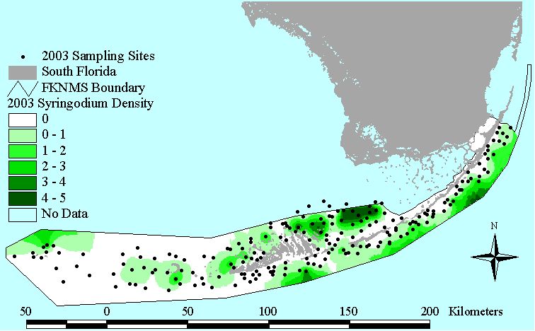
Syringodium filiforme |
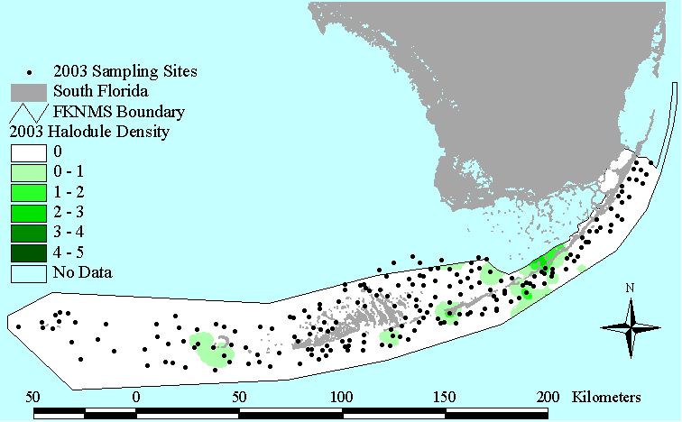
Halodule wrightii |
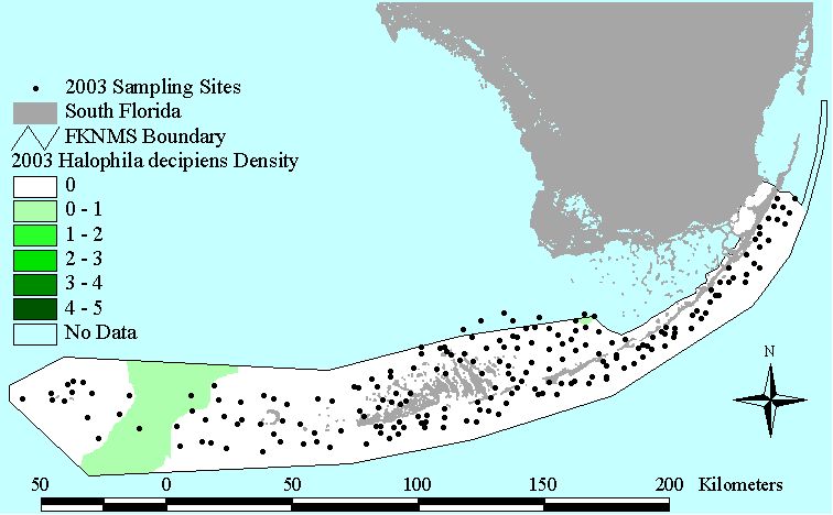
Halophila decipiens |
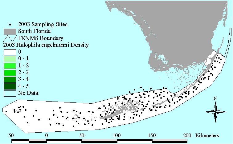
Halophila engelmannii |
2004 Survey
Click to download list of coordinates
(Site were sampled in 2004 at the same coordinates from 1997)
Detailed map of monitoring stations and links to digital photos
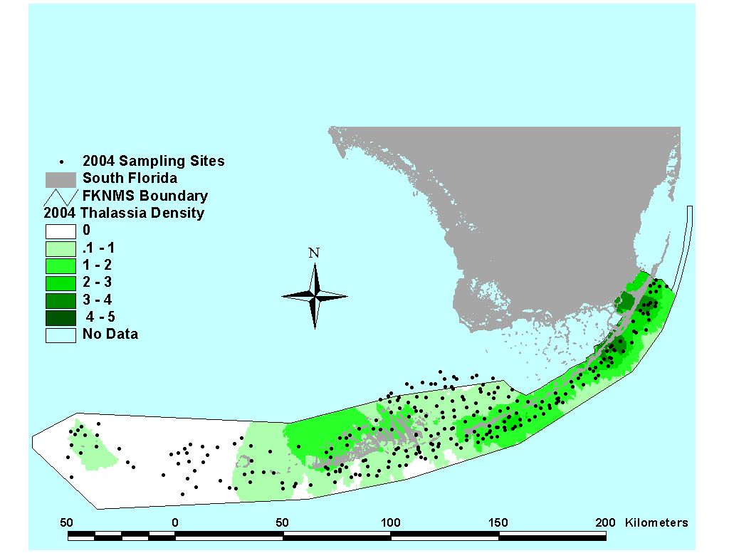
Thalassia testudinum |
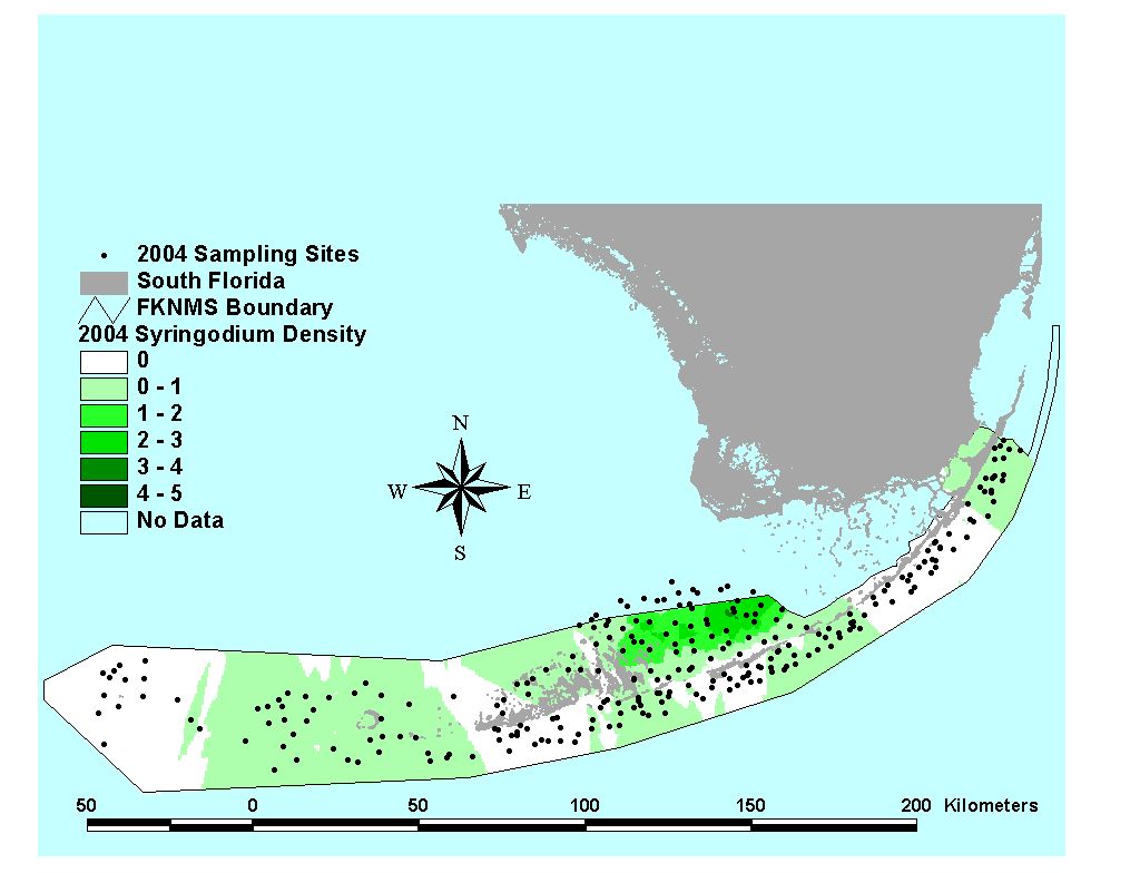
Syringodium filiforme |
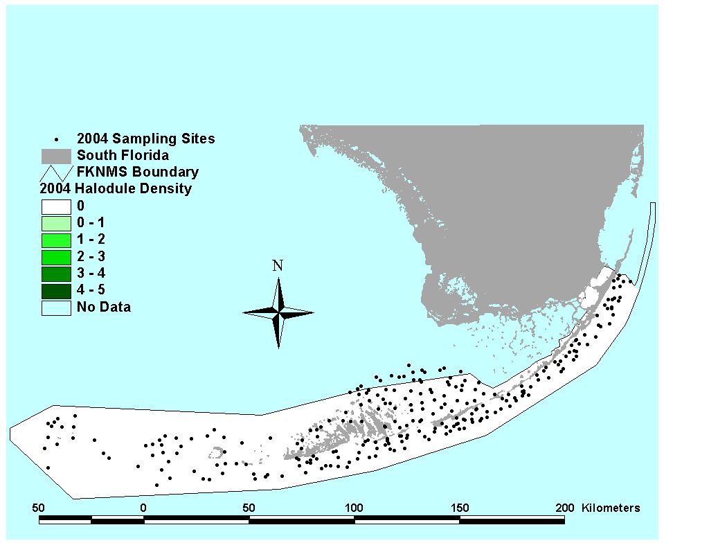
Halodule wrightii |
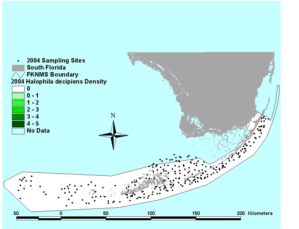
Halophila decipiens |
Halophila engelmannii |
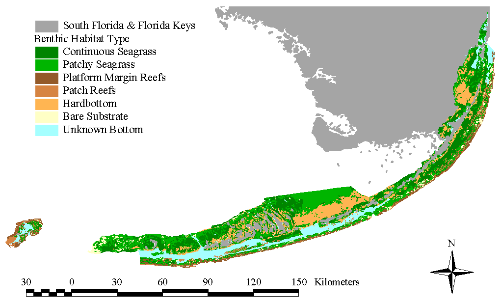
Benthic Habitats of the Florida Keys
Map based on 1992 aerial photography (FMRI/NOAA 1998)